
Three big reminders:
- Take lots of pictures. But leave any found geological, historic, and cultural artifacts untouched and in place.
- Always respect wildlife. If you really care about them, don’t feed them. Ever.
- Pack out your trash. Leave the wilderness like you were never there.
Level: Easy – No elevation gain, but great hiking walks nonetheless
Rift Valley Trail
Description: 1-mile walk one way –– from parking lot to bench overlooking the Rio Grande. Return the same way.
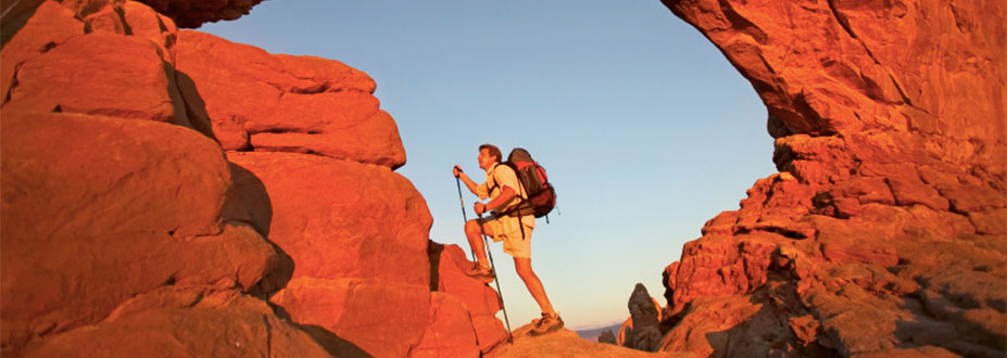
Photo ops: Majestic views of Taos Mountain and the surrounding desert mesa.
Shared trail: Horse riders, trail runners, and mountain bikers. Dogs on leash.
Good to know: Direct sun exposure; no tree coverage. Recommended seasons: spring, summer, and fall. Can be okay on some mild winter days. Year-round: sun is very strong; winds can be very strong.
Location: Hwy 68 South; 10 miles from Historic Taos Plaza. At approx. mile 9, begin to slow down and indicate turn to other drivers. Small hiker symbol sign and trailhead entrance on your right (the west side of highway).
West Rim Trail
Description: 1-mile walk one way –– from parking lot to bench overlooking the Rio Grande Gorge Bridge. Return the same way.
Photo ops: Majestic views of the Sangre de Cristo Mountains and the surrounding desert mesa.
Shared trail: Horse riders, trail runners, and mountain bikers. Dogs on leash.
Good to know: Direct sun exposure; no tree coverage. Recommended seasons: spring, summer, and fall. Can be okay on some mild winter days. Year-round: sun is very strong; winds can be very strong.
Location: Hwy 64 West; 13 miles from Historic Taos Plaza. Follow signs for Rio Grande Gorge Bridge. Enter long, paved driveway to State Park parking lot. Trailhead entrance is directly across from men’s restroom.
Level: Moderate – 1,114 feet elevation gain
Devisadero Loop Trail #108
Description: 5-mile hike one way –– from trail entrance to peak. Return the same way.
Photo ops: Expansive views of the town of Taos, Sangre de Cristo Mountains, and the desert mesa.
Shared trail: Horse riders, trail runners, and advanced uphill mountain bikers. Dogs on leash.
Good to know: At .5 miles, take left fork for the ridgeline, which is a more moderate hike to peak. Even along the ridgeline (not just at the peak), you get good views. Direct sun exposure; limited tree coverage. Recommended seasons: spring, summer, and fall. Not recommended for winter. Year-round: sun is very strong; winds can be very strong.
Location: Hwy 64 East; 2.5 miles from Historic Taos Plaza. Parking is on your right, at El Nogal Picnic Area. But the Devisadero trailhead is across the highway.
Special note: If you start on a trail in the parking lot (crossing a little footbridge), that is the 20-mile one-way South Boundary Trail #164, with an elevation gain of 3,560 feet.
Level: Moderate to Difficult – 849 feet elevation gain
Williams Lake Trail
Description: 2-mile hike one way –– from the parking lot to the lake. Return the same way.
Photo ops: Alpine beauty of Williams Lake, Carson National Forest, Kachina Peak, Wheeler Peak, and Taos Ski Valley.
Shared trail: Highly popular hiking destination year-round; winter snowshoeing. Dogs on leash.
Good to know: Walk from trailhead toward ski lift, past the residence and signs for “private property.” Be respectful of this granted easement for public access to the trail. Walk onto Taos Ski Valley property, stay to the left of Lift #4, and hook left past the Phoenix Grill onto ski trail. Stay on left for left turn to Williams Lake. Hike through spruce forest. At mile 1.5, you reach Wheeler Peak and Williams Lake junction. Follow sign to Williams Lake; .5 miles more. Direct sun exposure; some forest canopy overhead. Recommended year-round.
Location: Hwy 64 West to Hwy 150 North; 19 miles from Historic Taos Plaza. Enter Taos Ski Valley main parking lot, stay left for Twining Road. Follow Williams Lake signs up steep, unpaved, switchback road. 4WD recommended; required in winter.
Special note: Trailhead begins at 10,191 feet above sea level. At this high altitude, this moderate hike can feel difficult.
Level: Difficult – 2,974 feet elevation gain
Wheeler Peak Trail
Description: Approximate 3-mile hike one way –– from the Williams Lake parking lot to the peak.
Shared trail: Highly popular hiking destination. Dog owners under your own advisement; this is a rocky, steep, and narrow switchback trail.
Good to know: Walk from trailhead toward ski lift, past the residence and signs for “private property.” Be respectful of this granted easement for public access to the trail. Walk onto Taos Ski Valley property, stay to the left of Lift #4, and hook left past the Phoenix Grill onto ski trail. Stay left for left turn to Williams Lake. Hike through spruce forest. At mile 1.5, you reach Wheeler Peak and Williams Lake junction. Follow sign to Wheeler Peak. Exit spruce forest and begin rocky, steep ascent on narrow switchback trail. Direct sun exposure on switchback trail; no tree coverage. Recommended seasons: summer (after snow melt) and early fall (before snow). Year-round: sun is very strong; winds can be very strong.
Location: Hwy 64 West to Hwy 150 North; 19 miles from Historic Taos Plaza. Enter Taos Ski Valley main parking lot, stay left for Twining Road. Follow Williams Lake signs up steep, unpaved, switchback road. 4WD recommended.
Special note: Remember the effects of high altitude on physical performance, even for the most acclimated hiker.
What about Taos Mountain?
Taos Mountain is a sacred mountain to the Taos Pueblo Indians and is located within Taos Pueblo boundaries. Taos Mountain is never open to the public. There are no trails, no maps, and no guides. We encourage you to visit Taos Pueblo, the only living Native American community designated both a UNESCO World Heritage Site and National Historic Landmark.